


157M+
Parcels Nationwide
3,230
Counties Covered
99%+
US Coverage
Authoritative Data
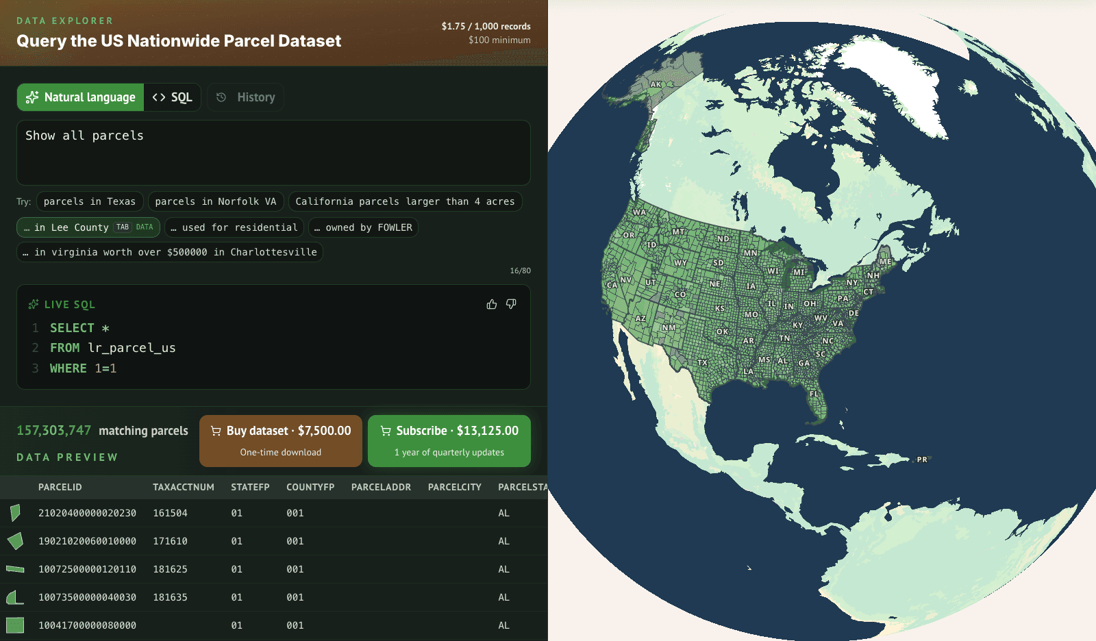
Instant Bulk File Downloads
Our authoritative United States parcel dataset includes a rich set of land, building, and ownership attributes.
All datasets include quarterly updates for one year.


Enterprise Solutions
Managed Parcel Web Service
Easily integrate our nationwide parcel layer into your application or website using our standards-compliant Parcel Web Service.
WMS/WFS/WMTS
Low Latency
Vector & Raster
Why Choose Us
How do we stack up?
| ReportAll | Regrid | ||
|---|---|---|---|
| Parcel Identifiers | Yes | Yes | Yes |
| Validated Addresses | Yes | Yes | Yes |
| Validated Geometries | Yes | Yes | Yes |
| Ownership Information | Yes | Yes | Yes |
| Parcel Schema | Public | Public | Public |
| # of Fields | 90 | ~75 | ~100 |
| Update Frequency | Quarterly | Monthly | Unknown |
| US Coverage | 157M+ | 160M | 159M |
| County Pricing | $100 – $350 | $200 – $400 | $600 – $800 |
| State Pricing | $750 – $2,500 | $900 – $9,000 | $6,000 – $12,000 |
| Nationwide Bulk Download Pricing | Up to 80% off Regrid. | Unknown | $90,000/yr+ |